Episode 2 – Olivia Jones – Lundy
November 2020 [45.16 min]
Olivia Jones’s podcast is centred around a recent journey to Lundy Island in the Bristol Channel. Speaking with artists, geologists and those working to protect the island’s wildlife, the recording explores the island’s volcanic history and how those living on Lundy have engaged with the material of the island over time.
Transcript: Please see at the end of the page.
Lundy Island Resources
Many thanks to Oliver Barrett for sharing his recording of the seal sounds on Lundy!
Of the earth
Of the earth is a project created by artist Olivia Jones and is an expansion of a residency undertaken by the artist with the University of Oslo’s geological research team Ashlantic on Fur Island, Denmark in 2017.
In 2020 Jones received an artist bursary from a-n, The Artists Information Company whose yearly bursaries are aimed at supporting artists at a crucial time in their practice.
Jones’s bursary will be used to develop the Of the earth project and gather research along the Western Coast of the UK. Along with the trip to Lundy Island Jones is also planning to travel to Scotland and islands along the Inner Hebrides, sites connected by material from the same period of ancient volcanism and global warming as Fur Island. These journeys will be used to gather materials and develop a network of people for Of the earth.
“My hope for the project is to develop a conversation with other individuals and communities about our earth histories and futures, to reflect on our position in this current cyclic event and the echoes and portents contained in the material of the earth.”
Fur Island, Denmark
The island of Fur is a small and secluded island in Denmark. 15,000 years ago, the huge ice sheet that covered Scandinavia and parts of the British Isles pushed some of the sediments in the North Sea into folds in front of the ice. Now that the ice is gone, the folded sediments remain. These particular sediments are very interesting to a geologist, as they accumulated at a very important period in Earth history.
Find out more here.
University of Oslo: The Centre for Earth Evolution and Dynamics
Their Vision: ‘The Centre for Earth Evolution and Dynamics (CEED) is dedicated to research of fundamental importance to the understanding of our planet. The research embraces the dynamics of the plates, the origin of large scale volcanism, the evolution of climates and the abrupt demise of life forms. This ambitious venture will hopefully result in a new Earth model that explains how mantle processes interact with plate tectonics and trigger massive volcanism and associated environmental and climate changes throughout Earth history.’
In the podcast episode
-
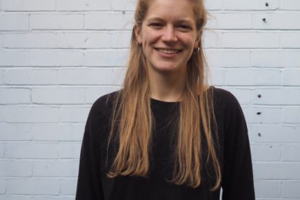
Olivia Jones
Olivia Jones is a visual artist based at Spike Island Studios in Bristol. Working predominantly between sculptural and drawn processes she create works that explore the behavioural characteristics and structural potential of materials, objects and phenomena within landscapes.
-
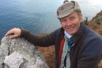
DougalEARTH
Professor Dougal Jerram is a geologist based in the UK. He runs a geological company called DougalEARTH and is also a research professor at the University of Oslo in the Centre for Earth Evolution and Dynamics.
-
Rodney Harris
Rodney Harris is a sculptor and printmaker. His work includes a long term collaboration with artist Valda Jackson. In 2017, Harris and Jackson won the Marsh Award for Excellence in Public Sculpture for ‘Four Brick Reliefs’ on the Peabody Estate in Clapham.
-

Alice Cunningham
Alice Cunningham is a visual artist with a diverse practice working with a breadth of materials, renowned for her sculptural carvings and work in social engagement. Alice is equally passionate about concept and materiality in her artwork. She has exhibited widely throughout the UK and internationally.
Producer of the podcast episode
EarthArt
‘EarthArt is a series of collaborations between contemporary artists and scientists from the School of Earth Sciences at the University of Bristol. Each collaboration consists of a six-month artist Fellowship followed by a six-month exhibition in the unique EarthArt Gallery. EarthArt has been running continuously since 2015.
“Earth Sciences encompasses not just rocks and fossils, but increasingly climate change, oceanography, natural hazards, evolution and extraterrestrial life. There is a lot of materials for artists to explore and we thought this was a great chance to bring artists into the School to meet with scientists and the wider academic community through a six-month duration Fellowship.” Professor Jon Blundy, EarthArt Co-Founder.
“The idea of developing the Fellowship and Gallery was to address two things: firstly to deepen the dialogue and investigation between Artists and Earth scientists, generating new ways of visualising research; and secondly to create a Gallery to share this work with a wider public.” Rodney Harris, Artist, EarthArt Co-Founder.’ – EarthArt Website
Previous EarthArt Fellows include artists Rodney Harris, Alice Cunningham and Olivia Jones.
The Bricks Podcast follows Bristol’s contemporary artists, on journeys within the city walls and beyond, along the leylines of the South West, up the A roads north, and through their unique observations on the world.
With thanks to Arts Council England and National Lottery players for funding this podcast series.
Supporter
Episode 2 – Olivia Jones – Lundy – Verbatim Podcast Transcription
Rodney Harris [00:00:07] There’s something romantic about an island isn’t there, there’s something sort of magic. Or certainly a small island I think. Yeah…
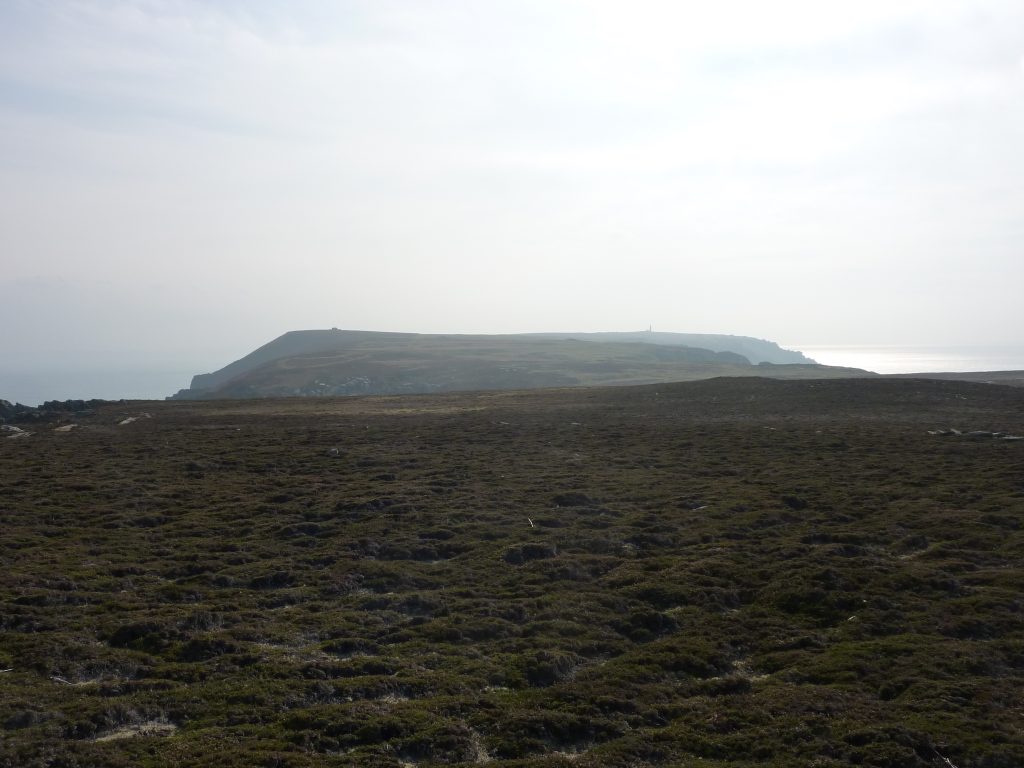
Olivia Jones [00:00:27] At the far western point of the Bristol Channel where the flowing waters meet with the Atlantic Ocean stands a small defiant island of granite. Three miles long and half a mile wide it looks like a compass point rising out of the sea, pointing due north to Caldey Island on the Pembrokeshire coast and south to Hartland Point and the Devon-Cornwall border. From the sea the cliffs of the island rise up steeply, white spines of rock exposed and worn by the buffeting sea winds. My name is Olivia Jones and I’m a visual artist based at Spike Island Studios in Bristol. Geology and geological visual language are influential in my work and fuel an interest in material memory and material journeys. It was the granite of the island that brought me to Lundy. The hard granite stone that has been carved out of the island to build the houses that support its community is also the focus of research by a group of geologists looking at the volcanic origins of its formation to see whether it might be able to tell us something about our future. During this recording you will hear the voices of those with an interest and an investment in those stones alongside the voice of the island itself and the wildlife that it’s home to.

Rodney Harris [00:01:54] We stayed in the lighthouse. It’s called, I think it’s called the Old Lighthouse because there’s since another one has been built but it’s unbelievably grand in scale. They made it from granite and they built a tower for the light which was 600ft high and then when they built it they found that it was so high that it was in the clouds so you couldn’t see it. So they actually then, once they’d built it put a light at the top, couldn’t see it so they then put a hole in the bottom of it and put the light out the bottom which is crazy innit! In the lighthouse it has granite fireplaces that, they look as if they’ve come out of a stately home. I think that it was intended to give the lighthouse keepers a sense of the gravity of their role in protecting the shipping lanes and to protecting the ships by making this grand fireplace. It’s truly mindboggling. There’s a piece of granite that makes the fireplace that must be 5 or 6 tonnes in weight. I mean it is just unbelievable. And you can climb up to the top and watch storms come in and they sort of split around the island. It’s, it’s stunning.
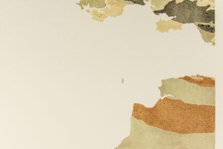
Olivia Jones [00:03:34] The first geological map of Britain was made by William Smith in 1815. In 2015 Bristol based artist and sculptor, Rodney Harris, created his own version by grinding down rock samples he’d collected into inks that could be printed to correspond with the rock beds they represented on the map. In his studio at Spike Island Rod showed me the section of the map that contained Lundy.

Rodney Harris [00:03:59] So I’m guided by the colours really because the colour determines the, or suggests there’s something different. It’s quite monotone, you know, on the surface. I mean the granite on Lundy is really lovely, it’s a light… it’s quite a light bluey, bluey-grey. The difficulty with making inks from rock is that you don’t know what the colour’s going to be. It doesn’t always follow that the colour of the rock is the same colour as when you grind it up. Colour is a very odd thing that I don’t really understand. I mean for example, there’s slate… a lot of that region is slate isn’t it and there’s probably a bit of slate on Lundy. But Cornish slate is green and Welsh slate is purple, and you just think slate is slate, you think of slate being grey but it’s sort of green-y and purple. And there’s also a bit of silver in Lundy so actually when I start off calling it monotone but it’s got greys and blues and silvers. The reason why I like that one is because it’s so… it’s like you’ve got the two big fellas and then you’ve got little Lundy.
Dougal Jerram [00:05:32] Those types of maps, I mean they’re unusual maps because they’re exactly the same sort of maps that I’m used to looking at, I’m not interested in the roads and bridges and so on and where the towns are, it’s more we colour the maps due to what rock types are on the ground beneath our feet and so we’re in a very lucky position in the UK that from the north to the south of the UK we cover almost all of the geological time periods and rock types that we have in Earth’s history. In such a small condensed area we can cover a whole range of different parts of Earth’s history in terms of the geology and obviously Lundy forms one part of that puzzle.
Dougal Jerram [00:06:12] My name is Professor Dougal Jerram and I run a geological company called DougalEARTH in the UK, but I’m also a research professor at the University of Oslo in a research centre called the Centre for Earth Evolution and Dynamics and within that centre we look at volcanos and how volcanos have effected climate through Earth’s history. So one of the areas of research that I’ve kind of been involved with ever since I started geology really was looking at the fascinating volcanic rocks that we have in the British Isles. These include the islands of Skye, Rùm in Scotland, the Antrim flood basalts in the Giants Causeway in Ireland but also the furthest south expression of this volcanism is on the island of Lundy, so it’s always been somewhere that I’ve wanted to go and visit.

Dougal Jerram [00:07:06] We have a research project underway funded by the Norwegian Research Council called Ashlantic, it’s quite a catchy title, it’s all about trying to link the products from some of the explosive volcanic eruptions that happened in the past around the British Isles and off in Greenland to some of the deposits that we get in places like Denmark, in some of the rocks that we explore in offshore in the North Sea and the Norwegian margin and even all the way up to the island of Svalbard in the Arctic we find rocks that have expressions of this volcanism. And what happens when you have an explosive eruption is you send small shards of volcanic material up into the high atmosphere and it gets distributed around the planet and where this drops out of the sky in seas and oceans it forms thin layers within the sediments that get buried through time and these are called ash layers so hence the term Ashlantic. So we’re looking at the record around about 56-55 million years ago when there was a lot of volcanism happening at the onset of the breakup between Europe and America and during this volcanism there were big explosive events that caused large eruptions sending ash out in to the surrounding sedimentary basins and we’ve been looking at trying to link some of these ash layers with the actual volcanic centres and interestingly the Isle of Lundy, just off the Devon coast, is one of these volcanic centres that was active in and around this particular time.
Rodney Harris [00:08:55] The interesting thing about geologists is that if you ask them to describe or to name a particular rock they don’t tend to do it because it’s very hard to say what a type of rock is or to be absolutely specific. I mean they would be able to say like ‘it’s a limestone’ for example but to go quite specific is quite difficult. But it helps you to understand where you are you know? It kind of gives you a deeper sense of where you are when you’re with a geologist I think.

Morgan Jones [00:09:33] My name is Morgan Jones, I’m a geologist at the Centre for Earth Evolution and Dynamics at the University of Oslo. My research is in something called large igneous provinces which are periods in earth history when a lot of magma has come to the surface in a very short space in time and how they interact with the environment and various climate cycles. The best estimate that we have in terms of volume of magma that came to surface between 60 and 54 million years ago is about 10 million cubic kilometres of magma. So I did a little bit of maths and it would be the same as if you drew a direct line from London to Birmingham, so that’s about 200km, and that would be one side of a cube that would then go… so 200km London to Birmingham, probably another 200km Birmingham to Bristol and then 200km in to the air, and that much magma is what we’re talking about. It’s a huge amount of magma to have come to the surface.
Dougal Jerram [00:10:52] Now in the Isle of Lundy it’s actually, we’re looking deep inside what was probably an ancient volcanic centre so a lot of the material that built up the volcano has eroded down through time, we’re talking sort of 56-57 million years’ worth of time eroding the volcanic system and now we’re able to actually look into the guts of the volcano. And what you can see on Lundy, apart from a small slither where the boat actually joins the island there’s some deformed metamorphic/sedimentary rocks, almost the whole of the rest of the island is made up predominantly of granite, so the sort of thing that you sometime find on your kitchen table, but also it’s cut with a series of sort of sheets of different rock types that used to be hot molten magma deep in the Earth’s crust that was working its way up to the surface and feeding these volcanos. So what we’re aiming to do is sample that volcanic material and try and use that to get a very very precise age of when that volcanic centre was active.

Sophia Upton [00:12:01] I’m Sophia Upton. I was an Assistant Warden so it was a voluntary position where I was working on the island for three months and I was specifically looking at the seals and how it changed over the period of the pupping season.
Sophia Upton [00:12:19] There are so many cave systems on Lundy and a lot of climbers actively go to find those caves but the seals prefer caves that go into an incline so that when the tides rise the pups don’t get trapped inside. So there are specific caves that they prefer to go to just purely based on safety for the pups. You can normally hear them before you can see them a lot of the time. They’re very noisy [sound of seal noises] and because during pupping season they’re all on quite high alert because… I mean they are graceful and beautiful in the water but the minute they get on land they’re kind of just like squishy and they kind of just flop about [sound of seal noises]. They make all sorts of noises. They make purring sounds and they have like guttural screams at each other. Their voice really resonates on a lot of the cliff edges, so where there’s a cove, if they’re in the cove, it kind of bounces all the way up and you can hear, you can hear them before you get anywhere near the cove and you’re like ‘ah there are seals there’.

Olivia Jones [00:13:53] How easy was it to spot them on the rocks?
Sophia Upton [00:13:56] Despite pups being bright white you’d assume they’d be easy to see but they look a lot like granite, like wet granite glistening in the sun. So you’ll be like sitting there with your binoculars for 20 minutes staring at the same rock going ‘is it… has it moved yet? Is it, is it a seal? Could it be a seal?’ and then it moves and you’re like ‘oh yes, a seal!’
Olivia Jones [00:14:19] Like an endless game of rock or seal.
Sophia Upton [00:14:21] Basically, yeah.
Olivia Jones [00:14:28] In a stone shelter on the east coast of the island, looking out to sea, I met with Dean Woodfin Jones, the current Warden of Lundy. Dean has been working on the conservation and ecology of the island for the last four years as well as leading outreach for visiting groups and maintaining the island for those that stay here to enjoy and explore.

Olivia Jones [00:14:50] What brought you to Lundy then? How did you end up becoming the warden?
Dean Woodfin Jones [00:14:54] Well I studied applied marine biology, so I was a marine biologist up in Edinburgh, Scotland and I used to do quite a bit of work in and around those areas but I have always loved islands since I was a kid. My dad used to take me out to Rathlin which is on the North coast of Ireland and yeah we used to go out there seeing the seabirds all the time. So, yeah I fell in love with islands there and seabirds in particular, and then with my degree I kind of went off to all these other islands studying seabirds. And then when I finished my degree that’s kinda what I realised I wanted to do and kinda started jumping different islands working with seabirds in particular and conservation.
Dean Woodfin Jones [00:15:37] I mean the seabirds on the cliffs as well, you know they make it their home, it’s kinda guano enriched podiums on the granite and just poo everywhere and all the lichens around them, it’s just beautiful in the summer, so so busy. And then of course yeah on this side all the cabbage that makes its home in all the nooks and crannies as well.
Olivia Jones [00:15:56] What is the Lundy Cabbage?
Dean Woodfin Jones [00:15:57] So we have an endemic plant here, it’s found nowhere else in the world. Yeah so it lives pretty much on this part of the east and down in some of the valleys. It’s a brassica, just like, kinda looks a bit like… well it’s very similar to Isle of Wight cabbage but kinda rapeseed if you ever see that in the fields? Yeah kinda loose cabbage and then in the kinda spring-summer months it has these beautiful kinda tall storks with these gorgeous little kinda flowers with four pale yellow flowers, and they are absolutely beautiful and found nowhere else on the world apart from here on Lundy. And they’ve got two beetles with very original names, the Lundy Cabbage Flea Beetle and the Lundy Weevil, which are also endemic so yeah they’re found nowhere else in the world either apart from this tiny little rock which is yeah quite incredible.

Olivia Jones [00:16:44] A bit further up the coast to where we were sat talking are the remains of the island’s old quarries.
Dougal Jerram [00:16:51] You will have seen that granite is not just granite, everywhere you go there’s differences in the textures, some of the granites have really large of crystals in, what we call these megacrysts, these really large crystal rich granites.

Dean Woodfin Jones [00:17:08] All the buildings as well, North and South Light, the Marisco Tavern it’s all made from Lundy granite.
Olivia Jones [00:17:15] Is it true that, is the Old Light built from the Lundy granite as well?
Dean Woodfin Jones [00:17:17] I think it is yeah. It is yeah so most of the buildings I think have been made from Lundy granite but I know that there’s one or two that they had stuff brought over from. So yeah I think it’s pretty much. I mean Marisco Tavern was made when the quarry company was here in the late 1850’s – 60’s so yeah a lot of the infrastructure is down to the granite on that side and yeah the quarry workers at the time. So they got their priorities right anyways, they built a bar before the company set up, it’s maybe why they didn’t last that long!
Alice Cunningham [00:17:53] Yeah I think there’s just a particular energy when sheer material like that which has been formed through millions of years is sort of exposed and I think that can bring a particular energy to a place, for the sort of inhabitants of that space. I’m Alice Cunningham and I am predominantly a sculptor but I guess an artist is more of an umbrella term because I also create paintings and drawings. In the last few years, probably in the last 3-4 years, I’ve concentrated on stone carving and I sort of describe myself as equally with a foot in the more formal sort of aesthetic/form based sort of sculptural world and in the conceptual and more socially engaged world as well. What sort of really made me fall in love with stone was I was given the opportunity to go to Italy on a residency and work in the, in the marble quarries there and I had done a little bit of stone carving in Portland before that but I hadn’t ever really had the chance to do that much because I was living in London and in a small studio in Hackney which doesn’t lend itself to stone carving at all! Yeah, so I was given this opportunity to go to Italy and work in and around the sort of quarries there and that was what made me fall in love with it really was this idea of how stone is extracted from the landscape on such an enormous scale and then to hold that same marble in your hands…

Olivia Jones [00:19:30] It’s very calm round there, in the quarries.
Dean Woodfin Jones [00:19:32] It is beautiful yeah, yeah it’s just… and yeah they themselves, you know, provide a fantastic little habitat. There’s one which we call Rüppell’s Quarry because there was a very rare bird there once called Rüppell’s Warbler so yeah we birders called it that I don’t think it actually has another name! And then VC is very good for a bird called a Ring Ouzel and you get quite a lot of them during migration and they breed right up in the Highlands of Scotland and then elsewhere in Scandinavia. They look like a blackbird but they have a white bib. And then the very last quarry is really good because it’s really wet and you get sundew that grows in there which is a carnivorous plant, it eats flies and insects a bit like a Venus flytrap, so yeah there’s lots of weird and wonderful things in each of the quarry, they’re all different as well. I say every day’s different on Lundy anyway, particularly with me with wildlife it’s… it’s why I love it on here so much and why it’s so exciting as well because you just don’t know what’s going to turn up in the day.
Olivia Jones [00:20:37] How many seals would tend to see on a day?
Sophia Upton [00:20:40] Lundy on average has 200 seals but we had gone out once and we had counted like 250 seals so it really depends because normally seals go out on to rocks to like digest and to bask in the sun so if it’s not good weather for that they do prefer to stay in the water because they’re able to thermoregulate better in the water because that’s where they are naturally built to be. The main thing that the seals prefer is somewhere flat so what they do is during high tide they’ll find somewhere flat and they’ll kind of stack themselves up until low tide and then as the tide comes back up they’ll go back into the water the same way. So sometimes you’ll see seals in places that you couldn’t image them getting to with, with low tide. They’d be several meters away from water and they would just be sitting on a teeny tiny bit of a cliff edge just like lying there in the sun.
Olivia Jones [00:21:46] At the end March 2020, because of the national lockdown, the island was closed off to visitors and didn’t reopen again until later in July. Dean talked about how the wildlife of Lundy started to reclaim the spaces often occupied by people, including the deer that live on the island.
Dean Woodfin Jones [00:22:04] They come up dawn and dusk on to the top of island when people aren’t about but during shut down because there was only what 25 of us on the island, they were just coming in to the village, they weren’t fussed. Like we could walk within meters of them they just didn’t care and they kind of I think maybe potentially learned that, you now, the islanders were no threat at all. So yeah they were a lot more relaxed during lockdown. And then obviously as well the island just went wild, it, all the footpaths with you know obviously all the reduced footfall, nature was just really just trying to kinda reclaim those areas which was, which was amazing to see. But yeah quite a bit of work to keep on top of. Yeah, it was amazing to see the island in that kind of setting because I don’t think anyone’s kinda seen it in that light for a very long time. Yeah, there’s always been lots of people here doing, you know, either with the visitors since the Heaven, Heaven era in the 1830’s onwards or, you know, the quarry company, all the people who used to work up there, you know, taking the granite off to say other areas of the South West and that. There’s always been lots of people here so it kind of felt maybe a little bit of what Lundy may have been like you know with, you know with just a really handful of islanders maybe back during, you know, Mesolithic times when all the guys were up the north of the island, hunting and gathering up there. Yeah it felt, yeah like it was going back in time a little bit.

Olivia Jones [00:23:29] During my conversation with Morgan at the University of Oslo I asked him what Earth would have looked like during the geological period that the created Lundy.
Morgan Jones [00:23:36] Plate tectonics is going on all the time and we’ve had some big break ups and collisions between plates in the last 500 million years or so but if we’re going back just 56 then we have more or less the same dynamic – like the plates in the same sort of positions as they are today. But very very importantly for, for our work is that at this time period in particular there is no permanent ice at either pole, so there’s no ice sheet on Antarctica, there’s no Northern Hemisphere ice sheets in Greenland or North America or anything like that so it’s, it’s a very very warm climate. And in particular there’s, there’s evidence from Svalbard that there were temperate forests and crocodiles living in Svalbard at the time, and Svalbard hasn’t changed much it terms of its latitude between then and now so effectively we’re seeing conditions that can support crocodiles at 70-74 degrees north or something so that’s, that’s very very interesting and very strange. It was, it was a little bit different, it’s around the time that mammals started to fill the evolutionary niches and begin to take over from the birds and the dinosaurs in terms of the apex predators. Yeah, so it was a very interesting time.
Olivia Jones [00:25:05] I don’t know what’s more terrifying, picturing Svalbard with loads of crocodiles or with loads of polar bears…
Morgan Jones [00:25:10] [laughs] Polar bears are worse!
Olivia Jones [00:25:13] Polar bears are more terrifying yeah.
Sophia Upton [00:25:17] Lundy, it, it’s just impressive that the seals can even pup there because a lot of places aren’t really good habitats for pupping because of how the tides work and despite the island kind of going north to south it does have curve in it and that’s why the east coast is better because it’s more sheltered from, from like the winds and the waves. It’s kind of got a more like c-shape in to, in to the east which I’m sure is probably why it’s less sheer cliffs on that side of the island as well just because it’s battered less than the west side of the island.
Olivia Jones [00:26:00] It’s quite interesting to think of like the parallels between the seal community kind of thriving there and the human population that have lived on the island, you know, it’s quite a hard island to exist on especially in terms of access from the sea. It’s quite impressive how both species have adapted and have kind of thrived on it.
MS Oldenburg safety announcement [00:26:26] Ladies and gentlemen please listen very carefully to the following safety announcement. Your attention is drawn to safety instructions displayed in public areas. Those include the method of donning a lifejacket. Lifejackets can be found under your seats in the forward saloon and after saloon and will be distributed by a crew member in the event of an emergency. The general alarm signal is either seven or more short blasts followed by one full long blast on the ships whistle or two tone sirens. If you hear the signal stay where you are bestowing the ship’s crew for actions to take.

Dougal Jerram [00:27:00] You know because you have to get on a boat to get to the island it does kind of remind you of, you know, of a sort of almost like a Jurassic Park-esc kind of area. You, you arrive on the jetty and you’re sort of exposed to this beautiful quite dramatic scenery, obviously the granites form fairly pronounced cliffs, predominantly around the island, so there’s, there’s actually very few places that you could land a boat on the island and that’s also one of the reason why there’s a whole bunch of shipwrecks around the island, I noticed when I was in the bar on the island they have a map of all of the different ship wrecks that have happened. Partly actually the, the geology, the rocks of the island, are in part due to its difficulties in terms of the seaways because actually the volcanic rocks extend a little bit more offshore and so the waterways in and around the island have some sort of treacherous shallows and so on. So it’s not just the island itself it’s the very fact that the expression of the island continues just in the shallow subsurface of the water that makes it quite complicated from a seagoing perspective.

Olivia Jones [00:28:06] The Ashlantic project that Dougal and Morgan have been working on began in 2017 and has been looking in to the potential correlation between the formation of the North Atlantic Igneous Province, the volcanic activity that formed Lundy, and a period of global warming and climate change events that occurred between the boundary of two geological epochs, or ages, called the Palaeocene and the Eocene.
Dougal Jerram [00:28:31] This time as you said is known as the Palaeocene Eocene Thermal Maximum so it’s a period in the Earth’s history around about 55.8 million years ago where there was a dramatic shift and the temperatures increased quite dramatically and it’s thought that one of the triggers of the this particular activity is down to this increase in volcanic activity associated with the break up process of Europe from the North American continent. And again what we’re trying to do here is many of these rocks have already been dated so we know roughly know what their ages are but we have techniques in Oslo where we can get the ages down to around about a sort of plus/minus 30,000 year window and we can do that, if we can achieve these very very high precision ages, instead of just knowing that we’ve got a cluster of volcanos all the way up the coast up in to Scotland and offshore that will have fed these ash horizons we can potential pinpoint exactly you know the ‘smoking gun’ if you will of the volcanos that caused the ashes. And in doing so we’re kind of trying to unravel what exactly was happening a little bit just before this time period, so around about sort of 57-56 million years ago, and then over this Palaeocene Eocene Thermal Maximum time when we see this dramatic shift in the climate.
Olivia Jones [00:29:56] In 2018 artist Alice Cunningham created a body of work through the University of Bristol’s EarthArt Fellowship programme under the self-elected title of ‘What Does Climate Change Look Like?’
Alice Cunningham [00:30:07] So over six months, I worked with lots of different scientists having a series of interviews it started out asking them about their practice and asking them what kind of visual cues they use to talk to their students about their topic and about climate change and to kind of impart information. You know, I met with chemists and geologists, oceanographers, people looking at the sort of social aspect of it, you know, glaciologists, it’s such a wealth of information and expertise at the university so it was really interesting to hear about what they were looking in to. I was totally sort of blown away by that but also to, to look at the visual, you know, that was where our understanding began to kind of resonate and cross over was the visual material. Yeah the visual language really, that’s something that really was a surprise for me was actually that as a sculptor and as climate scientists we had a very similar visual sort of language that we could kind of understand and share. Through the series of interviews I then sort of took away a lot of the information and these, these sort of visual language that all these different scientists were using to talk about climate change to talk about these very very complicated, very detailed topics. The kind of headlines that I came away with to work under as an artist to produce then my own body of work and my own sort of response to all of their information were these subtopics of ‘unprecedented rate of change’, ‘unstable objects’, ‘tipping points’ and ‘the study of fractures’, fractures and lines on a surface to try and impart information.

Morgan Jones [00:31:45] There’s one very special climate event within the general Palaeocene-Eocene time and it’s right at the boundary, in fact that’s the reason the boundary is there. So we had climatic conditions about 10 degrees warmer than now worldwide in the late Palaeocene, so about 56 million years ago, and then we have a 4-5 degree global warming event that occurred very very quickly and lasted for 100-200 thousand years. So the PETM as it’s called, the Palaeocene Eocene Thermal Maximum, this is the closest natural analogue that we have to what may happen in the future with today’s warming because it was caused by a very large release of carbon to the atmosphere in a very short space of time and one of the hypotheses that we want to test is if the North Atlantic Igneous Province could be responsible.
Morgan Jones [00:32:47] One of the most important things about the PETM is that there is still some uncertainty about what caused it and if we get a better understanding of what caused it we would have a better understanding of how the earth system is going to change in the next 1000 years or so. There are several competing hypotheses for what was the main driver of the PETM. If it’s the, the North Atlantic that’s the most dominant thing then we are looking at a scenario where we can perhaps feel like we can do more to fight global warming and try and mitigate our impact on the environment. But essentially what we really need is a better understanding of how, how the earth system can be perturbed.
Dean Woodfin Jones [00:33:42] Well I think Lundy just ties in to the rest of the country in a lot of that ways, I mean, my kind of climate knowledge in particular is with the kind of distribution of marine life and how that kind of ties in with the food chain. So we are kind of particularly worried about a lot of our seabird species in particular around the country at the moment and we are seeing massive declines in some of the species on Lundy, particularly things like Black Legged Kittiwake which used to nest here in, you know, tens of thousands but we’ve only got you know roughly around 300 pairs now on the island, and I think a lot of that is down to climate change unfortunately. So it’s, it’s quite a complicated kind of thing but it kind of comes down to the very basis of the food chain and how things like plankton are changing in their distribution, certain copepods in particular, so little shrimp in the waters, there’s different species now that are moving northwards which tend to kind of hold the food chain together here in the South and elsewhere as well in the country, and we’re starting to see that shift northwards now and a more southern kind of copepod which tends to appear much later in the season becoming more dominant which isn’t very good for the fish that then need to feed on them and then subsequently the seabirds. So we are losing a lot of our birds because of the way the climate is changing and a lot of the distributions as well where birds, things like Kerloo’s and Lapwings and things, they used to breed a lot here in the south of England but they’re all disappearing from here and kind of moving northwards now and we’re seeing a lot of southern species which never used to be here kind of turning up and yeah making their home now, so it is changing, well yeah, pretty much the whole dynamic of kind of what’s going on wildlife wise in a lot of places in the country including Lundy.

Olivia Jones [00:35:28] If there is a correlation between these two events how would that knowledge help us in tackling current global warming?
Morgan Jones [00:35:37] It could possibly give us a way out in terms of mitigation strategies as well because one of the ways to take carbon out of the atmosphere is by weathering silicate rock which the North Atlantic Igneous Province is a large amount of. When you take a lava that’s cooled and formed rock and you erode it with water and then you form clays and other elements that get taken by rivers to the oceans, the stuff that gets taken by rivers to the oceans is the perfect building blocks for little sea creatures to make their shells out of and most of those shells are, are carbonate. So if you can get enough nutrients to the oceans then you start being able to allow those ecosystems to consume carbon into carbonate shells and those shells sink and then you have depleted the atmosphere in CO2. So one of the biggest negative feedbacks to warming is the erosion of silicate material and the basalts of the large igneous provinces are the easiest of those silicates to erode. So it’s possible as a mitigation strategy to try and sort of geoengineer, essentially break mountains apart and fertilise oceans and stuff like this, so it’s quite extreme stuff but there is, there’s several ways that we can do this going forward.
Olivia Jones [00:37:12] It’s quite infectious the enthusiasm that most geologists have. I mean it’s not a, a profession that you fall into accidently… it’s a real love for the landscape and I think it’s, yeah, it rubs off!
Alice Cunningham [00:37:27] It’s just amazing how they read it because you know I’m used to reading the art world or critiquing artworks and visual culture and you know I’d sort of, I’d say I’m becoming a bit of an expert at that, you know that’s what I’ve been trained in and spent, you know, a lot of time doing… but they critique the landscape, you know, they critique the natural world and look at these rocks and analyse the rocks and kind of the history of what’s there and I find that fascinating. As humans we all, you know, we all love to communicate and kind of have dialogue and it’s just that I think for different people that dialogue is, is in a different, you know we’re experts in different fields of dialogue and as artists it’s, it’s visual you know that’s how we communicate often best and, you know, a topic so important as climate change, you know, we need to sort of honour it and give it our best shot in trying to talk about it in all sorts of ways so that we can bring everyone in to that discussion.
Olivia Jones [00:38:26] I guess it must be a sort of a bit of a microscope being here because, because you can monitor things so closely and because it is an island and you can, you can track these changes perhaps far more accurately than you could do on mainland.
Dean Woodfin Jones [00:38:37] Exactly, yeah yeah yeah. And I know while we’re trying to get a lot of the marine studies kind of put in place again now but we’ve got a lot of quite unusual and quite rare invertebrates that are kind of living around Lundy under the water. Things like Corals, Pink Sea Fans and Cut Corals and things so they’re kind of on their kind of most northern distribution here now on Lundy. A lot of monitoring has been done in the past and we’re trying to kind of re… well bring that back up again to see how that’s changed now and potentially if there is with kind of changes kind of subtle changes in sea temperature, are we actually seeing a lot more of those southern species around the island now and are we kind of losing the kind of more northern species or the species that we would think that should be here normally, are we starting to lose them or are they starting to change due to changes in yeah sea temperature as well? So we do have temperature loggers here, so we do actually record the sea temperature as well out at sea and then we’ll tie that in with you know what’s going on species wise, abundance and kind of distribution around the island.
Olivia Jones [00:39:37] I guess you always think about the decline of certain species but not the influence of new species kind of travelling to warmer climates.
Dean Woodfin Jones [00:39:43] Exactly yeah.
Olivia Jones [00:39:44] It could look very different in the future couldn’t it?
Dean Woodfin Jones [00:39:47] It could indeed yeah, as I say, yeah particularly with birds anyway I mean because they are quite visual and you know a lot of people are so in to birds, it’s quite a… they’re a really good environmental indicator.

Rodney Harris [00:40:02] I mean it’s almost like a ship, Lundy.
Olivia Jones [00:40:08] In shape?
Rodney Harris [00:40:10] Yeah I suppose in shape, and also the way that, the way that the landscape changes over time. You know, I suppose, how long will it be there? You know, and, we think of it as permanent when in fact it’s constantly moving, you know.
Dean Woodfin Jones [00:40:38] I mean the island itself it’s seen a lot of changes with staff and people coming over and researchers. Yeah there’s always so much going on here it’s kind of always changing forever little bits, if you know what I mean? But, at the same time, Lundy always stays quite the same, it’s kind of old school! [laughs] Yeah…
Olivia Jones [00:40:57] I think there’s something so charming about that though.
Dean Woodfin Jones [00:40:59] Yeah it is, yeah, and that’s why I love islands, it’s a kind of, life’s a little bit more simple but you work a lot harder I think and you’re much more, well you’re a lot closer to nature. Our day is kind of dictated by the weather so I feel a lot more connected to nature that way, the island decides on what we can do kinda work wise each day, I find that very refreshing, yeah.
Morgan Jones [00:41:34] There’s not going to be one saviour to what we’re about to face, if we’re going to do it properly we need to reduce the amount that we are emitting to the atmosphere and we need a mixture of natural and synthetic measures to be able to take it out of the atmosphere as well, so this includes reforestation, trying to encourage silicate weathering wherever possible. So there’s, there’s no one answer to the problem but I think we’re at the position now where the science is sure enough that we, we understand the problem and we have a good handle on a myriad of possible solutions, it just needs the investment and dedication of policy makers to be able to make it happen.
Rodney Harris [00:42:32] Geology is mind boggling, isn’t it, the way that time and… you know getting a sense of it when our time is so short… If you could jump 50 million years in to the future our present would be a slither of something somewhere that you could look at and analyse. I’d love to be able to do that, to see the coast, or to see what was going on.

Olivia Jones [00:43:08] I hear we might be in for rough weather tomorrow? Someone said to check how we’re getting back?
Dean Woodfin Jones [00:43:11] Yep [laughs]. Yeah I don’t think it’s be 100% confirmed yet but I’m looking at the forecast and I think, yeah, you’ll be going off on a helicopter tomorrow –
Olivia Jones [00:43:19] oh amazing.
Dean Woodfin Jones [00:43:21] – which is really cool, so yeah you’ll see Lundy from the air. And obviously then you’re not going to have a bumpy 2 hour crossing, you’re going to have 7 minutes in a helicopter and then.
Olivia Jones [00:43:30] I mean, I’d rather forego the choppy sea!
Dean Woodfin Jones [00:43:35] Yeah the helicopter’s good fun.

Olivia Jones [00:43:45] Thanks to Dean Woodfin Jones and Sophia Upton on Lundy Island; Artist’s Rodney Harris and Alice Cunningham in Bristol; Professor Dougal Jerram and Dr Morgan Jones at the Centre for Earth Evolution and Dynamics at the University of Oslo; Rowan Bishop, Jack Gibbon and Jessica Ackerman at Bricks and to a-n Artist Bursaries 2020.
Voice of Ash Kayser at Bricks [00:44:10] This podcast was brought to you by Bricks. Bricks brings together the people of Bristol through collaborative art projects, public realm producing, community lead co-design and securing the spaces our communities need to thrive. On our site you’ll also find a blog post with links and images related to the subjects covered in this episode and profiles of all our artists and projects so go check it out at bricksbristol.org. As a new independent charity we rely on the support of people like you so that we can support our communities. If you can, please consider supporting our work through donating the price of a sandwich, buying a tote bag or purchasing an artwork from our online shop. Big thanks to Arts Council England and National Lottery players for funding this episode as part of the Bricks Artist Programme.
END OF TRANSCRIPTION